Sangay Volcano


Sangay Ecuador
Sangay constitutes an elevation of great geological interest, due to its permanent volcanic activity with the presence of fumaroles, eruptions and burning lava flows. At night it offers natural displays similar to pyrotechnic games which are observable even from El Puyo.
Sangay is one of the most active volcanoes in the world. A symmetrical cone and flanks with a steep slope give it an aspect that, surely, also makes it one of the most photographed. Impressive paintings are obtained from the east and, during the nights of its volcanic activity.
With regard to wildlife we can witness species such as: moor wolf, cervicabra, spectacled bear, mountain danta, eastern danta, anteater, deer, puma. Among the birds are the torrent and common ducks, Andean seagull, curiquingue, and the majestic condor.
Among the most outstanding species of flora we have: pumamaqui, alder, lycopodia, chuquiraguas, gentian, neurolepis, achupallas and pajonal; and a wide variety of orchids and bromeliads.
The walk to Sangay is a real challenge, the same that is done from the town of Alao there are approximately 12 hours of walking to the sector called Yanayacu, from where it takes approximately 5 more hours of walking to reach the sector known as La Playa, From this site the ascent to the volcano begins, always in the early hours of the morning.
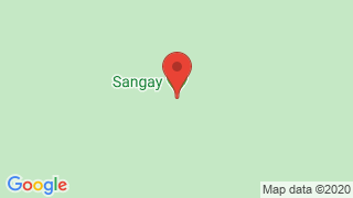
Sangay Ecuador location it is the last volcano south of Ecuador, located in the Cordillera Real, in the Province of Morona Santiago, 30 kilometers from Macas. It has a height of 5,230.
Sangay Ecuador climate: Its minimum temperature is 13 degrees Celsius and the maximum is 32 degrees Celsius.
Sangay Ecuador last eruption Its last eruption was in 1628 until the present
Sangay Ecuador how to get there
From Quito It is headed by the Pan-American South of Quito to Riobamba (194 km). From this city you can access several sites.
- Atillo Take the road to San Luis until you reach the Guamote - Macas road that leads to the community of Atillo (74 km).
- Ozogoche The Pan-American South is taken until the deviation of Charicando, in the area of Palmira (64 km); from there you travel 35 kilometers on paved roads along the road that leads to the “Y” of Totoras community. Here you take a second order route until you reach Ozogoche Alto.
- Altar. Take the road to Penipe (22 km) and then continue along a second order road until you reach the Candelaria parish where the control station and entranc e to the park are located.
- Inca Trail (Qhapaq Ñan). Take Riobamba - El Tambo route. You can enter the roadfrom Achupallas town or from Culebrillas lagoon (to get to this site you start from El Tambo town).
- Culebrillas Lagoon. The Panamericana Sur is taken from the city of Riobamba up to 2 km before El Tambo. On the left is the entrance to Pillcopata

Publicado en:
Publicado por:


